GPS Network in Canary Islands and Fogo, Cape Verde
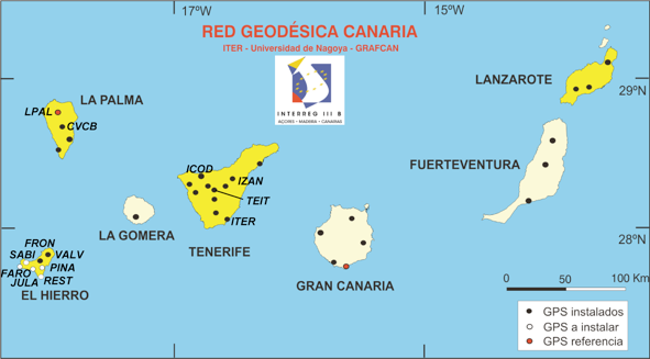
The GPS network in the Canary Islands, Spain, is being operated under a collaboration of ITER, GrafCan, and Nagoya University.
Reference site for the coordinate time series is: STEI (in Tenerife)
El Hierro
La Palma
La Gomera
ALAJ pdf
Tenerife
Gran Canaria
MAS1 pdf
Fuerteventura
Lanzarote
YAIZ pdf
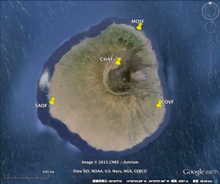
GPS network in Fogo
Fogo (SAOF, MOSF, COVF, CHAF) pdf
CHAF site was removed in November 2014 because of the lava flow from the eruption of Fogo in November 2014.
We use Bernese GPS software version 5.2 with IGS final/rapid orbit and earth rotation parameters. Several IGS sites are included in the analysis so as to refer to the ITRF2014 coordinate system. The time series data above are referring to LPAL site in La Palma.
Copyright @2019, 2020 Takeshi Sagiya All Rights Reserved